

Best hiking trails in Estepona. Discover the best hiking routes in Estepona to enjoy unique experiences surrounded by nature.
The city of Estepona is internationally known for its historic center, its beaches and its great tourist offer. If you dare to let yourself be carried away by its streets and corners full of the essence of an Andalusian town, visit our post on what to see in Estepona.
In addition, Estepona has wonderful natural enclaves of great natural wealth, where fauna and flora abound in all their splendor.
In today's post we explain the best hiking trails in Estepona with which you can travel kilometers that will immerse you in the wonderful natural environment of Estepona. You can choose between different levels of difficulty, both routes to enjoy with the family or for the most athletic.
If you are thinking about doing any of these trails, at Espacar we will help you with car rental in Estepona so you can access them.
6 hiking routes in Estepona
Pinsapos Walk
This route is linear and lasts one hour, ideal for children and the family given its low difficulty. Along this path, you will find a distinguished landscape of Spanish firs, a type of fir that makes up one of the jewels of Sierra Bermeja. This is a unique route in the world, as the firs are found on peridotite rock, a type of rock of volcanic origin and a garnet color that is very characteristic of the area.
The starting point is kilometer 2.5 on the road from Puerto de Peñas Blancas to the Agustín Lozano Shelter. The end of the trail is marked by an area known as the plaza that you will find after crossing a small bridge over the Algarrobo gorge. To return, you take the same route as the outward route.
Port of Peñas Blancas and the Refugio de los Reales
This is a linear route lasting three hours.
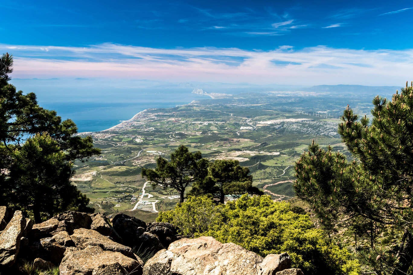
The trail begins at the Agustín Lozano Shelter. Ascend the paved path that leads to the parking lot of a recreational area. Here you will find the beginning of a path of about 500 meters that will take you to one of the most characteristic points, the Mirador de Salvador Guerrero, where on clear days you can see Africa, the Strait of Gibraltar and the Costa del Sol.
Royals Peak
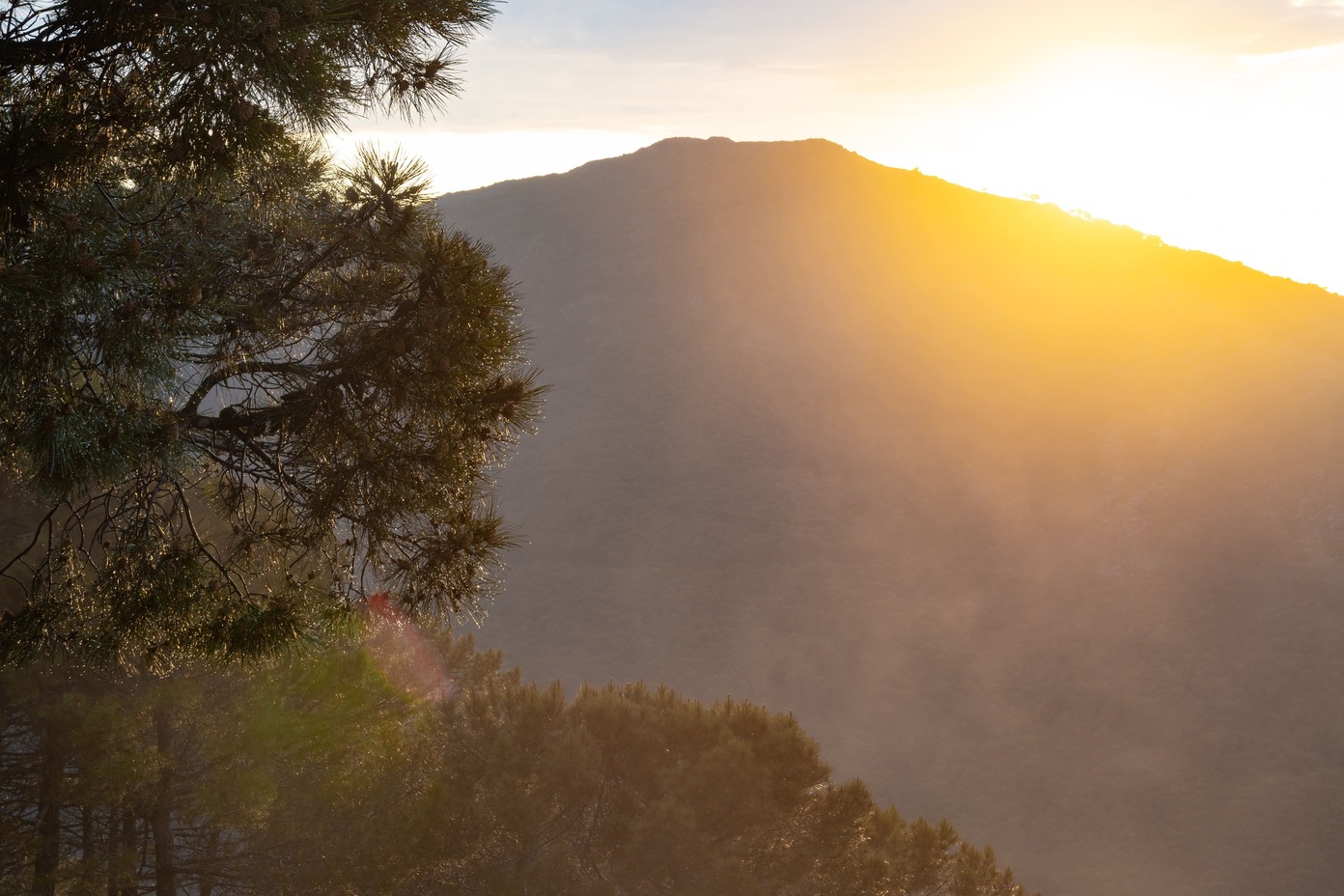
This route lasts about eight hours. Due to its steep slopes, it has a high level of difficulty that requires a high degree of physical fitness. It is a path full of cork oaks, pine forests and fir trees that will take you to the highest peak in the Sierra, 1450 meters above sea level.
To access it, we take the same path as the Refugio de los Reales route. Just before reaching the Mirador de Salvador Guerrero you will see a sign indicating the SL-A 168 trail towards the Pico de los Reales. Ascend the concrete track until you reach some stairs on the left that will take you to the highest peak.
Porrejón Fountain
Easy and linear path perfect to enjoy with the family. On this route we will find resin pines, which were of great importance during the last century for their resin extraction in the old factory of the municipality.
Its beginning is located at kilometer 12.8 of the MA-8301 highway called Carril de Alacrán, on the climb to Peñas Blancas. We follow the path until we reach the Loma del Nicio firebreak, where we will find a path to the right that will take us to the Fuente del Porrejón.
The way back is the same as the way out.
Guardian House
Linear route lasting 3 hours, quite simple since its slope is not very steep and its path is quite homogeneous.
The path begins just before the bridge that crosses the AP-7. We will go to the Camino de Nicola, where a unique farmhouse from 1780 is located. During this route, you will be able to see numerous cork oaks and resin pines. Continue the route until you find the old house of the forest guards who controlled the public forest area.
To return, you take the same route as the outward route.
Path of the Altabacales
This path is a highly difficult route recommended for the most experts since it is 20 km long with a gradient of about 750 meters. This route runs along one of the most famous roads in Sierra Bermeja due to its old resin exploitation, where you can see the characteristic fauna and flora of the area.
Now that you know the best hiking trails in Estepona, see how to go to Estepona to escape the noise of the city and enjoy unique experiences in the best natural enclaves that the municipality has to offer.
Back