

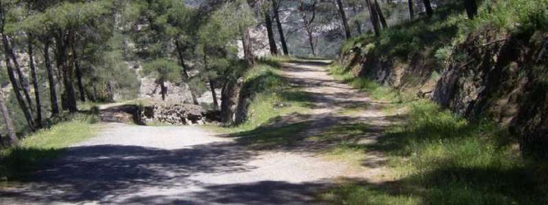
There can't be many avid ramblers out there who would argue that Andalucia isn't a walker's paradise. There are literally hundreds of walking routes of varying difficulty within the region, the climate is near-perfect all year round, and the landscape is vast, variable and undeniably beautiful.
During the long, sweltering summer months it's advisable to stay away from the unforgiving, isolated rural territories - lest you sweat or dehydrate yourself to death - or at least keep any type of physical exertion to a minimum. September through to early October is the best time of year for walking holidays, as the temperatures cool and the colour of the leaves slowly begins to change.
Malaga province boasts walking routes of various distances and difficulty levels, from beginner/child-friendly to advanced/superhuman. In this post we will take a look at some of the most popular, broken down according to level of difficulty.
1. Rio Chillar
- Level: Easy
- Time: 6 hours
- Distance: 13.5km
- Climb: 81m - 425m
Although this route may not be too challenging in terms of the physical effort required, it is worth pointing out that much of it involves actually walking in the riverbed. Usually this is just an ankle-deep affair but if heavy rain has fallen recently the water level may rise to waist height!
Looming rocks flank each side of the riverbed for much of the way and it can feel a bit like being in an adventure theme park at times. About halfway along the route there is a large reservoir where you can cool off, and further along several smaller areas with waterfalls. It's a glorious hike and ideal for groups of varying ability.
How to get to río Chillar:
From Nerja, the easiest way to reach the river is to walk from Calle de Joaquin de Herrera, which is just behind the main bus station on Calle de Pescia. If arriving by car, you'll need to take Avenida de Constitucion and then the sharp left onto Calle Mirto, where you will find an urbanisation suitable for parking.
2. El Caminito del Rey
- Level: Easy
- Time: 5 hours
- Distance: 14km
- Climb: 305m - 448m
Despite what you may have read or seen elsewhere on the web, this is actually a very easy walking route in Andalucia, thanks to the recent redevelopment it has undergone. For many years this trail was only frequented by the very brave or harebrained adrenaline junkies, given that this 'little path of the King' - a staggering 105m at its highest point - used to be a mere ledge on the side of a gorge, with the odd hole-ridden footbridge.
These days visitors can rest assured that they will enter and leave in one piece, as new significant safety measures were put into place before its grand re-opening earlier this year. However, this doesn't mean you won't get a little dizzy when you stare down the chasm of the famous gorge. The views are magnificent and well worth making the trip for if you value good walking holidays.
How to get to Caminito del rey
You can take the train from either Sevilla or Malaga to El Chorro, the nearest train station to the site, where there are shuttle buses waiting (or you can walk the short distance). Arriving by car is a little more problematic as parking spaces are limited in the area, but it is nonetheless easily reachable via the A-357 if coming from Malaga or the A-384 if coming from Antequera.
3. Puerta Verde de Torrox-Frigiliana-Sierra Almijarra
- Level: Moderate
- Time: 6 hours
- Distance: 15.5km
- Climb: 487m - 825m
The lush green Sierra Tejada Natural Park unfolds dramatically across the south-eastern part of the Malaga province, connecting the alluring whitewashed pueblos Torrox and Frigiliana via the spectacular 'Puerta Verde' walking route.
Starting at Cuatro Caminos just beyond Frigiliana, the route is steeper to the right and becomes progressively steeper as you climb to the furthest and highest point of the trail, Collado Blanquilla. From here the views are incredible - sweeping right across the valley. Then it is downhill all the way back to the start, on the left side of the loop. It takes little over 6 hours to complete the hike at a steady pace, and is often used by horse riders and cyclists too.
How to get to Puerta Verde
If arriving by car, take the E-15 motorway, and then the MA-5105 road north at junction 292 to Frigiliana. To arrive by bus you'll need to go to Nerja first and then change here for Frigiliana. Tickets cost 1€ on the bus itself.
4. Rio de Los Caballos - Charco de la Virgen
- Level: Moderate
- Time: 3 hours
- Distance: 5.5km
- Climb: 331m - 478m
This is an alternative route to get to El Charco de la Virgen, a small lake with a majestic waterfall in the south-western area of the Malaga province. First, you must walk along the river for 3km, crossing about nine times as you go. On the way you will pass the 'acequia' (an irrigation canal) and a smaller waterfall. Beyond here there is a slight incline and then a pathless section (be prepared to get a bit wet) before the Charco de la Virgen emerges through the trees.
You should walk back the same way you came and then you have the option of taking a more forested route that passes via a viewpoint of Tolox before leading back to the car park where you started.
How to get to Ruta de Los Caballos
The route starts in Tolox, a small settlement north of Marbella. From Malaga, take the A-357, until you reach Zalea, where you must turn left onto the A-354. Follow this road until you reach Alozaina, where you must take the second exit at the roundabout onto the A-366. Carry on down this road until the left turn onto the A-7250, which leads to Tolox.
5. Sierra Huma
- Level: Difficult
- Time: 5 hours
- Distance: 9km
- Climb: 550m - 1,189m
The Sierra Huma is one of the most imposing peaks of the Malaga province. Although quite short, it is slightly more difficult than the other routes listed in this post because of the steepness of the climb and the uneven, rocky terrain in parts of the trail.
At the start there is a gentle incline and after about 1km there is a right turn into the forest, which takes you to the 'escalara Árabe - 'the Arabic steps', which are thought to have been assembled during the Moorish reign in Andalucia, although no actual evidence of their origin exists. This is where the trail gets very steep, and also where the views are the most spectacular - in the distance you will be able to see El Chorro and el Caminito del Rey (see number two on this list), a quite stupefying view. Beyond the steps there is a long section of a steady incline, until the paso Huma which is where the really hard work starts. The terrain here is very rocky and caution is advised. There is the option to deviate slightly by passing through el Tajo del Estudiante, where you can take in some more incredible vistas, though this will increase the distance covered. From here it's just 1km to the 1188m summit.
The route back is tame at first, but the gradient soon becomes steeper and the terrain turns to scree for about 100m. Beyond here the ground begins to level out and the walk back to the start of the route is a welcome relief from all the climbing and sliding!
How to get to Sierra Huma
Since El Chorro is so near, you can take the same directions as you would to get to El Caminito del Rey and park here (likewise with the train to El Chorro station). However there is a smaller car park closer to the start of the Sierra Huma trail, if you'd rather not walk from El Chorro.
Naturally after so much walking you'll be in need of some hard-earned rest, so why not put your feet up at one of our recommended best beaches in Malaga?.
If you're looking for a car hire this summer, check out Espacar's latest rental deals.
